The most common and most accurate CRS in use in the UK is the British National Grid OSGB 36 (EPSG:27700, accurate to 1m).
British National Grid references are given in two formats:
Alphanumeric: ST 59828 62724
Easting / Northing: 359828 162724
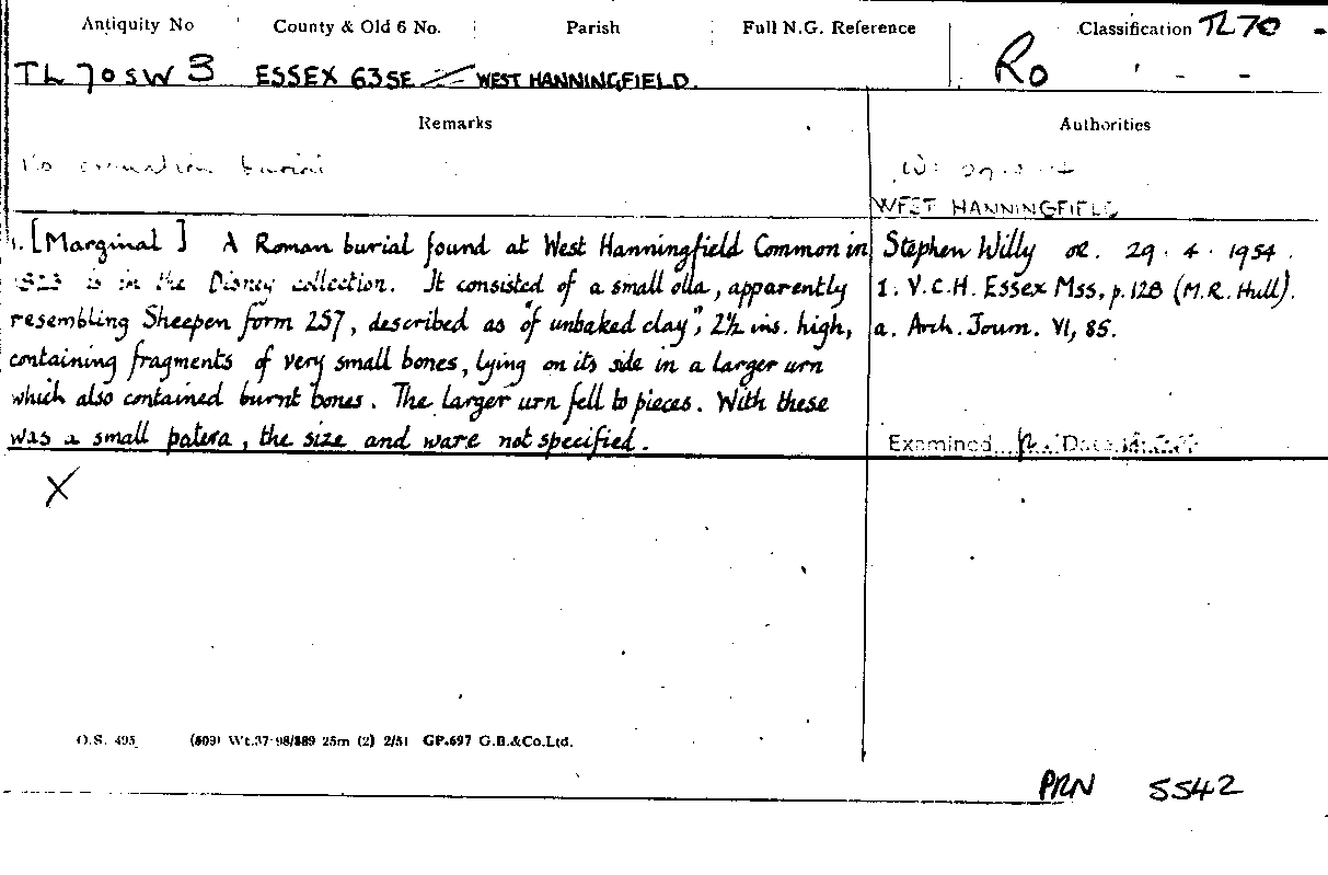
In the heritage sector we often use the alphanumeric system, both as co-ordinate references but also as part of our labelling structure for records and archives. An example of this is the OS index cards that formed the first Sites and Monuments records, (the precursors to our Historic Environment Records) where the Antiquity Number, the unique reference for the site, contains the National grid number of the 1:10,000/10,560 sheet within which the site falls.
Co-ordinates derived from and used by GIS are natively fully digital eastings and northings so we need to understand how to convert alphanumeric references to easting / northing and vice versa.
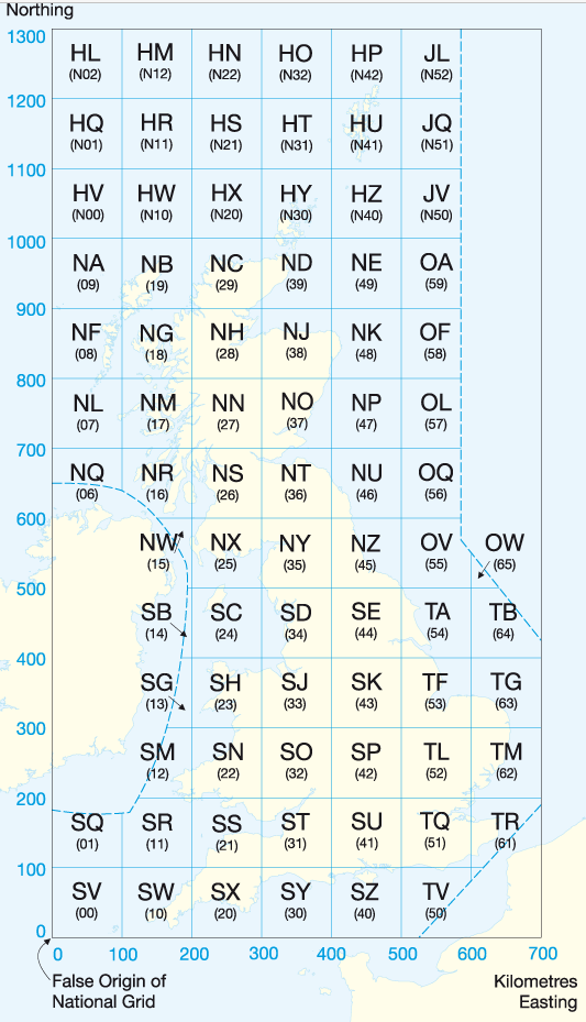
This video explains how the OS alphanumeric references show accuracy and how to convert them to eastings / northings for use in GIS. There is a link below to some practice exercises to embed your knowledge.