Welcome to our GIS for Historic Environment Professionals course! In this introductory segment we will outline the structure of the course and explain how we support you through your “GIS Zero to Hero” journey.
This course combines all the theory you need to understand GIS alongside four practical modules that build your professional skills. You can progress at your own pace through the course materials and don’t forget we also offer fortnightly informal drop-in sessions via Zoom if you want to work through the practicals with an expert in the room or just chat with the team and your cohort. The link to join these sessions is in your confirmation email. You can email me at rebecca@pushingthesensors.com for advice and support at any time. I will always do my best to respond within 48 hours.
Take a moment to watch our introduction video then complete our ready to begin quiz below to make sure you are ready to start.
Working through the course
This course is designed in sections and sub-sections, totalling 34 steps. Each step must be signed off using the “mark complete” button at the bottom of the page. You can view your progress on the homepage for the course.
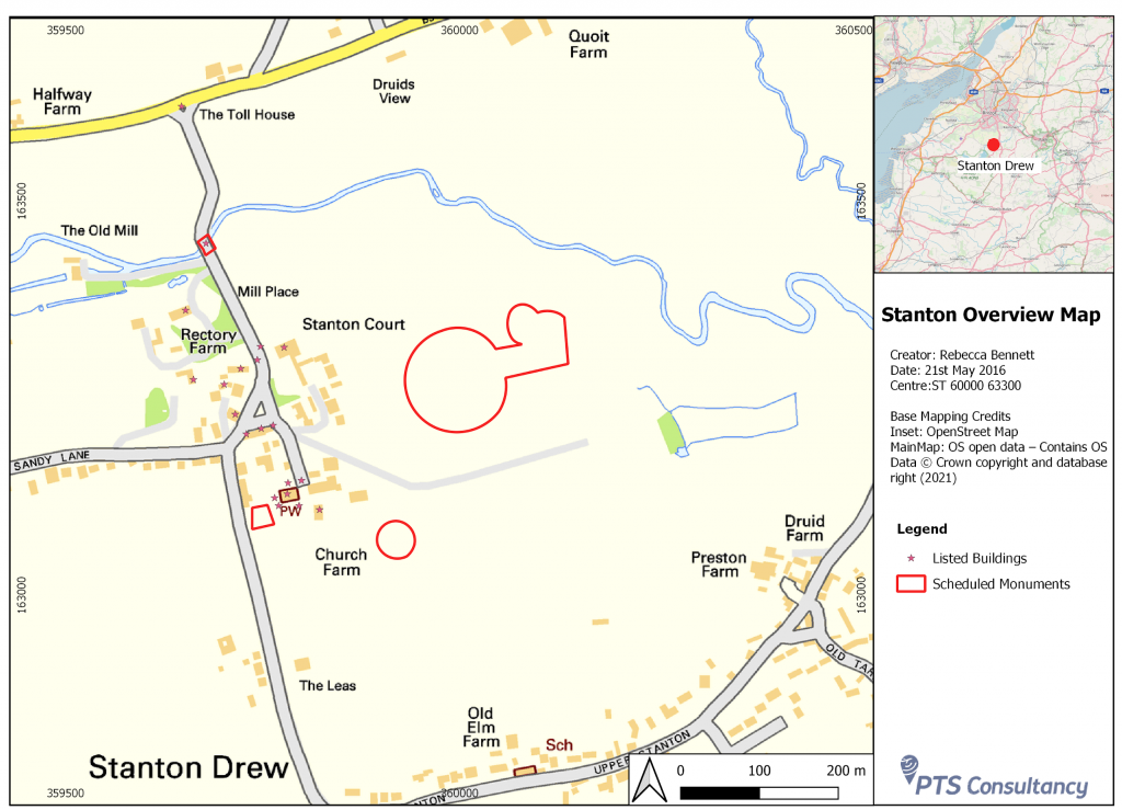
You must also submit an image or pdf of your professional-quality map (the result of Practical Workshop 4) which will be signed off by the course tutor before the course can be completed. You will also need to add progress screenshots at the end of each of the workshops 1-3 to demonstrate completion of the practical tasks. These will be signed off automatically allowing you to progress to the next step.
It is recommended that you work through the course in a linear fashion and complete the Introduction – What is GIS? and Basic GIS Concepts theory sections before attempting the Practical Workshops.
When you have completed the course you will be able to download a printable certificate for your CPD record from your account page.

Ready to begin?
Answer the questions below to make sure you are all set to start the course.