By default, you should always collect and store data in the most accurate CRS for your project area. If you are working in the UK this will be British National Grid OSGB36. All geospatial data that you acquire from organisations in the UK should also be in this CRS.
To seamlessly overlay data of different co-ordinate systems, QGIS will perform an on-the-fly transformation. This means that for the general QGIS user there seems to be very little work to do regardless of what CRS your data are in. However if there is a problem with your map, the data isn’t showing where you’d expect it or is out of line with your basemapping, then it is usually a mismatched or missing CRS that’s to blame.
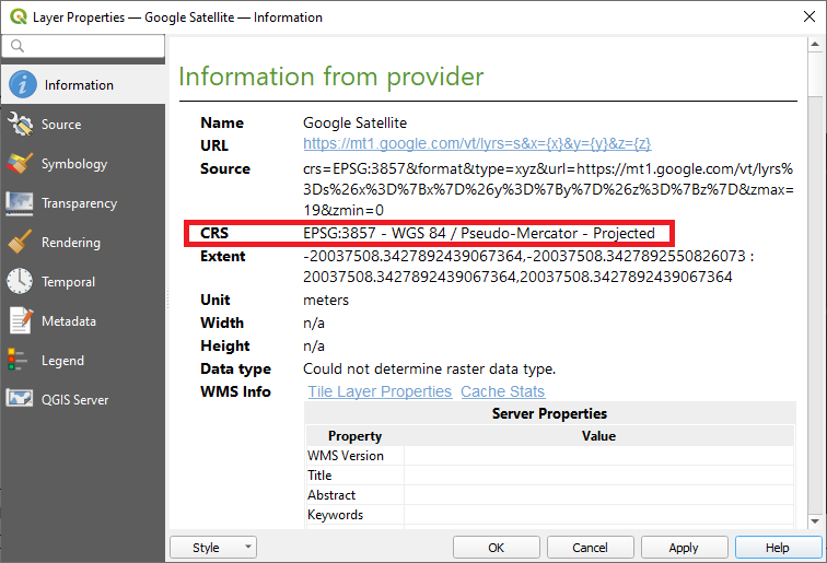
You can view (and edit) the CRS in the layer properties of any geospatial layer in QGIS.
In Workshop 1 you will learn how to set the CRS for your QGIS project and for individual geospatial data layers so that you can avoid or rectify CRS issues in your work.
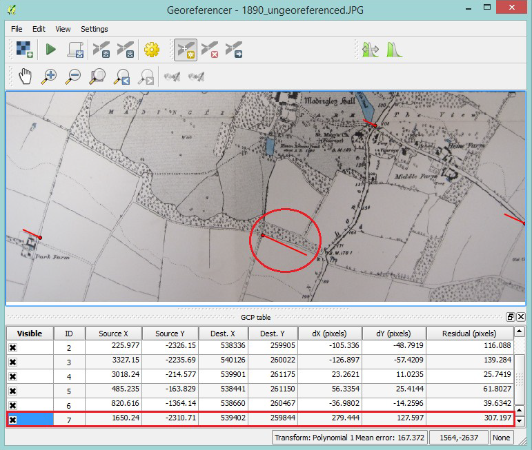
You will also learn how to georeference any image so that you can overlay photographs or scanned document that don’t have embedded geospatial data.